WEATHER 4pm UPDATE: Beta weakens but flash flooding possible
Published 4:30 pm Tuesday, September 22, 2020
|
Getting your Trinity Audio player ready...
|
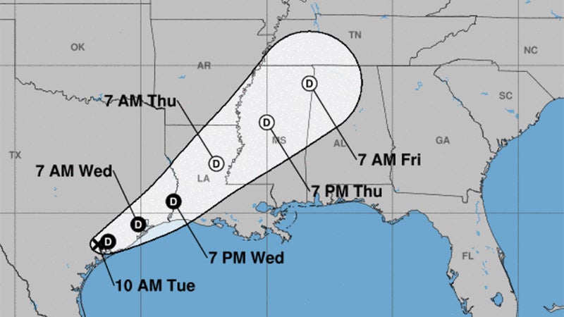
Beta, a weak tropical depression, will move up the Texas coast towards Southeast Texas tonight through Wednesday, according to the National Weather Service.
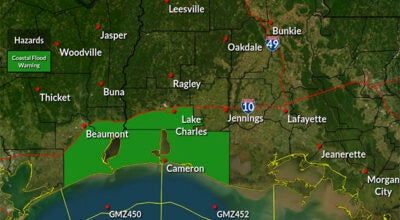
Wind gusts of 15 to 35 mph are expected, with the highest winds along and south of I-10 in southeast Texas and southern Louisiana.
Warning Coordination Meteorologist Roger Erickson said an additional one to eight inches is possible Tuesday night through Wednesday.
Flash flooding will be possible in Southeast Texas Tuesday night, extending into southwest Louisiana early Wednesday, and central Louisiana during the afternoon on Wednesday.
Storm surge of one to three feet above ground level will continue during high tides across the coast of Texas and Louisiana through Friday.
As of 4 p.m. Tuesday, the storm was 155 miles from Port Arthur.