National Weather Service updates threat of strong-to-severe thunderstorms later this week
Published 8:04 am Tuesday, January 31, 2023
|
Getting your Trinity Audio player ready...
|
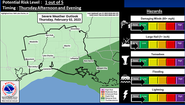
Strong to severe thunderstorms, according to the National Weather Service, are possible Thursday afternoon and evening.
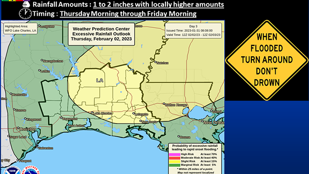
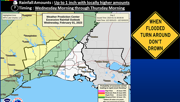
Weather watchers also warn of a slight risk of excessive rainfall Wednesday and Thursday.
An extended period of showers and thunderstorms will begin Wednesday morning as precipitation spreads into lower Southeast Texas.
Rain will increase in coverage throughout the day before continuing into Thursday when a low pressure center crosses south Louisiana as a congealed mass of heavy showers and some organized thunderstorms.
Due to saturated conditions, lower rainfall totals may still lead to minor flooding of urban and poor drainage areas, as well as cause creeks and bayous to overtop their banks.
Some thunderstorms may become strong to severe Thursday afternoon and early evening, particularly in south-central Louisiana parishes.
Damaging wind gusts and a brief, isolated tornado will be possible in stronger storms or line segments that may develop.
On Wednesday, there could be excessive rainfall with up to an inch and some locally higher amounts.
Primarily in northern Texas counties, there is a risk of more excessive rainfall.
On Thursday, that risk (expands to include most Louisiana parishes as another 1 to 2 inches of rainfall are possible with some locally higher amounts.
Stronger storms may have rain rates of 1+inch per hour.


