4 AM MONDAY: Nicholas is moving toward the north-northwest near 14 mph
Published 5:57 am Monday, September 13, 2021
|
Getting your Trinity Audio player ready...
|
As of 4 a.m. Monday, the center of Tropical Storm Nicholas was located over the western Gulf of Mexico about 45 miles southeast of the mouth of the Rio Grande River and about 200 south of Port O’Connor.
Nicholas is moving toward the north-northwest near 14 mph (22 km/h). The storm should turn northward later today and north-northeastward on Tuesday.
On the forecast track, the center of Nicholas will pass near or just offshore the coasts of northeastern Mexico and south Texas Monday morning, and move onshore along the coast of south or central Texas Monday afternoon or evening.
Maximum sustained winds remain near 60 mph with higher gusts.
Tropical-storm-force winds extend outward up to 115 miles from the center. Strengthening is forecast for Monday, and Nicholas could reach the northwest Gulf coast as a hurricane.
Weakening is anticipated on Tuesday and Wednesday over land.
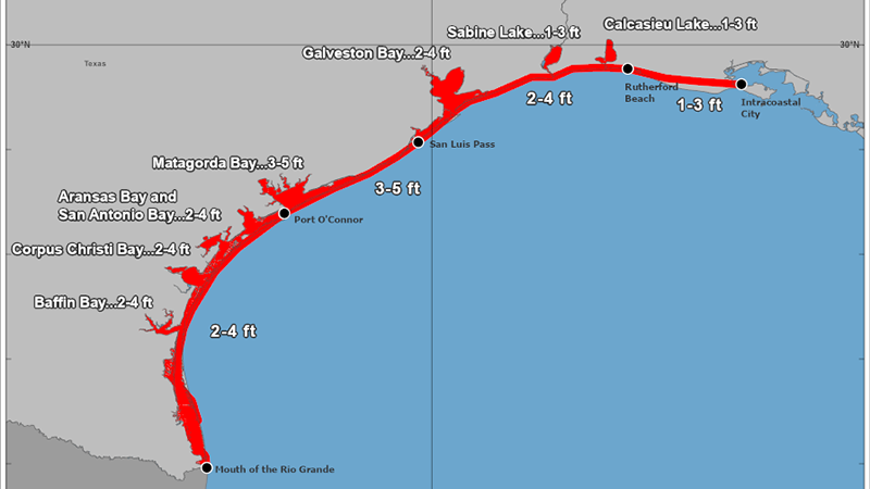
The combination of a dangerous storm surge and the tide will cause normally dry areas near the coast to be flooded by rising waters moving inland from the shoreline.
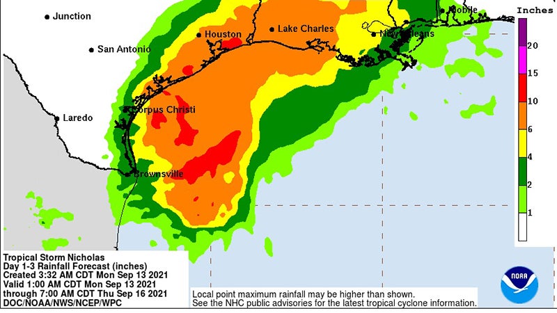
Nicholas is expected to produce storm total rainfall of 8 to 16 inches, with isolated maximum amounts of 20 inches, across portions of the middle and upper Texas coastal areas through the middle of the week.
Across the rest of coastal Texas into southwest Louisiana rainfall of 5 to 10 inches is expected. This rainfall may produce areas of considerable flash and urban flooding, especially in highly urbanized metropolitan areas.
Additionally, there is the potential for isolated minor to moderate river flooding.
Tropical storm conditions are expected to first reach the coast within the warning area in northeastern Mexico and southern Texas Monday morning, making outside preparations difficult or dangerous.
These conditions will spread northward within the warning area through Monday night. Hurricane conditions are possible in the Hurricane Watch area as early as this afternoon.


