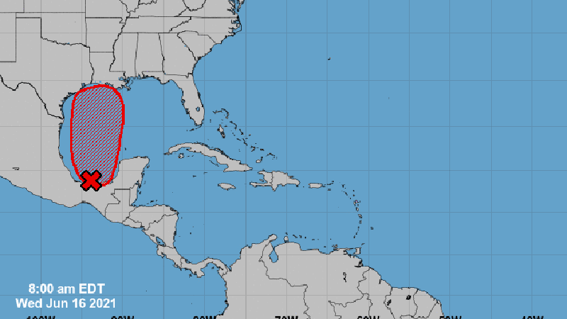
7 AM UPDATE: Potential tropical storm finally expected to start moving north
Published 12:01 am Wednesday, June 16, 2021
|
Getting your Trinity Audio player ready...
|
As of 7 a.m. Wednesday, the National Hurricane Center has a high 90 percent chance for tropical development on a broad low pressure area in the Bay of Campeche.
The National Weather Service said this system has moved little so far this week, but is expected to start moving north.
Warning Coordination Meteorologist Roger Erickson said it is expected to become a tropical depression late Thursday or Friday.
“For our region, we expect higher rain chances and elevated tides Friday through this weekend,” Erickson said. “Tides will run 1-2 feet above normal and rain totals will be 1-5 inches.”
Meteorologist Marti Calhoun told Port Arthur Newsmedia Wednesday morning that the storm is rotating, but weather experts “don’t quite have that kind of confection that we are looking to see that the storm is showing that it is getting its act together. We’re not sure on when that trigger point will be.”
Calhoun said the National Hurricane Center would not put out potential weather tracts or estimated arrival of winds until the storm is designated as a tropical depression.


