Damaging winds, large hail & tornados possible Wednesday, Thursday
Published 12:01 am Wednesday, December 23, 2020
|
Getting your Trinity Audio player ready...
|
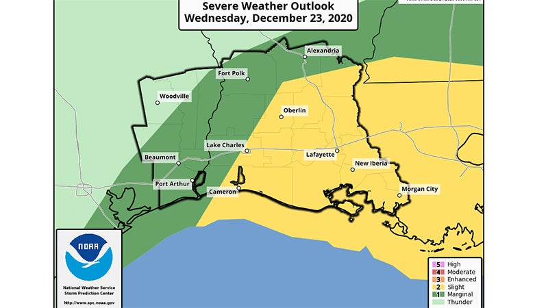
A strong cold front will move through the region Wednesday afternoon and Wednesday night.

Heavy rain and thunderstorms are expected.
According to the National Weather Service, there is a 5% risk for severe storms in Southeast Texas.
Damaging winds, large hail and a tornados are all possible.
In addition, during periods of heavy rain, roads may become impassable. It is harder to determine flooded roads during night hours.
One to three inches of rain is expected.
Warning Coordination Meteorologist Roger Erickson said behind the cold front, strong northerly winds will be sustained near 20 mph, with gusts in the 30s later Wednesday night into parts of Thursday.
A few power outages and tree damage are possible.


