Tropical Storm expected Friday, some Port Arthur impact comes into forecast
Published 6:34 pm Thursday, September 17, 2020
|
Getting your Trinity Audio player ready...
|
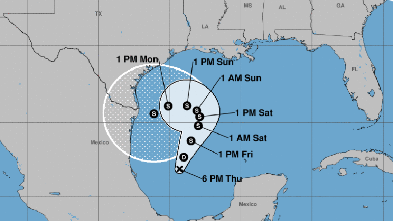
The National Hurricane Center has found a closed low level circulation this afternoon on the system in the southwestern Gulf of Mexico.
It is below tropical storm strength, so it is called Tropical Depression 22.
The National Weather Service said the initial forecast calls for it to strengthen into a tropical storm on Friday but meander in the western and southwestern Gulf through the weekend into early next week.
No landfall is projected yet.
Warning Coordination Meteorologist Roger Erickson said the main effect on our region will be elevated tides.
Tides will likely be two to three feet above normal later this weekend.
Low lying areas will have problems, like Highway 87 between Sabine Pass and Port Arthur, sections of Bridge City and Orange, downtown Cameron, sections of Highway 82 across Cameron and Vermilion Parishes, low spots in Intracoastal City, Delcambre, Cypremort Point and Burns Point.


