Your cell phone camera could be the key to greater flood protection
Published 12:30 am Friday, February 10, 2023
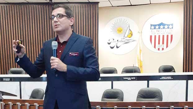
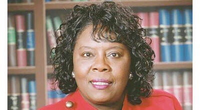
- Dr. Amir H. Behzadan of Texas A&M speaks Thursday morning at Port Arthur City Hall about the need for greater and more accurate flood information. (Stephen Hemelt/The News)
|
Getting your Trinity Audio player ready...
|
The key to better flood protection, navigation and eventual elimination is more information.
That flood information gets more useful when residents and first responders can access it in real time right down to specific block-level accuracy.
Port Arthur leaders hope to lead the effort to accumulate and distribute that information throughout Southeast Texas.
To do so, they are teaming with Dr. Amir H. Behzadan of Texas A&M, a Clark Construction-endowed Professor and graduate program coordinator.
Behzadan spoke at city hall Thursday morning about a new app that relies on community feedback and stop signs.
Behzadan feels there is a lot of uncertainty in the flood data collected and publicly available. He also said FEMA flood maps are not designed to predict or analyze flash floods.
To start addressing the issue of flooding, his program surveyed residents impacted by floods and emergency managers. Most of those responding wanted to know where floodwater was and where was it moving.
“That is what determines decisions in real time as they are deployed in the field or if you are homeowner and deciding if you are going to evacuate to a safer area,” he said.
That is where stop signs come into play. The program needs photos taken of submerged stop signs to be shared on an app platform Texas A&M created called blupix.
“When you take a photo with your phone, your phone records a GPS location of where you are,” he said. “We use that location and go back to Google Street View and find that same stop sign without the flood, so now we have a pair of photos of the same sign.”
Built-in artificial intelligence runs a computer model to detect the red octagonal shape of the sign, and the length of the pole under the stop sign determines how much water exists in that area.
Before the flood, the program has already determined the length of the pole, allowing a reading of water levels during a storm to be known.
“A good application of this is if you have enough of these individual points on the map, now you can run a navigation algorithm to take you from one point to the next while avoiding floods,” Behzadan said.
With enough information and local participation, the system could incorporate stop sign and flood gauge data and provide a personalized navigation path of where someone is and the path to the closest safe location.
Behzadan stressed he doesn’t want anyone to go into harm’s way to take a photo.
“Sometimes you are stranded at home, waiting for help and you can look out the window and see a stop sign,” he said. “Or there are search-and-rescue people floating on a flat boat or a Humvee helping people. They pass a lot of these intersections. They can (take pictures and) share this data with us.”
More detailed data collection could lead to better city planning and precautionary infrastructure construction.
Mayor Thurman Bartie encouraged community members to share any old pictures of floodwater near stop signs with the blupix app or take a picture during the next flood event for sharing if that can be done from a safe place.
City Manager Ron Burton said floodwater has no boundaries.
“Whenever Port Arthur floods, it is not only Port Arthur, it is regionally,” he said. “It affects all of us. We saw the opportunity to extend an invitation to other surrounding municipalities, as well as the county, because we are all in this together. We want to make sure we take some coordinated and collaborative approach.”
Learn more about the program at blupix.geos.tamu.edu.