Weather Service breaks down severe weather expectations this afternoon and Tuesday evening
Published 10:10 am Monday, January 2, 2023
|
Getting your Trinity Audio player ready...
|
Showers and thunderstorms capable of all modes of severe weather, as well as heavy rain leading to flash flooding, are possible, starting this afternoon and continuing through much of Tuesday.
According to the National Weather Service, damaging winds and isolated tornadoes remain the main threats.
A Flood Watch remains in effect for all of Southeast Texas as well as our northern Louisiana parishes, beginning this afternoon and continuing through Tuesday afternoon.
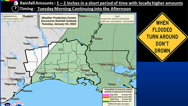
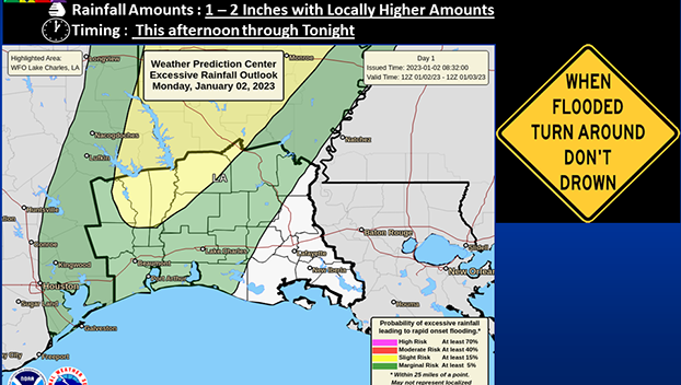
Widespread rainfall amounts of 1-2 inches with localized higher amounts are possible.
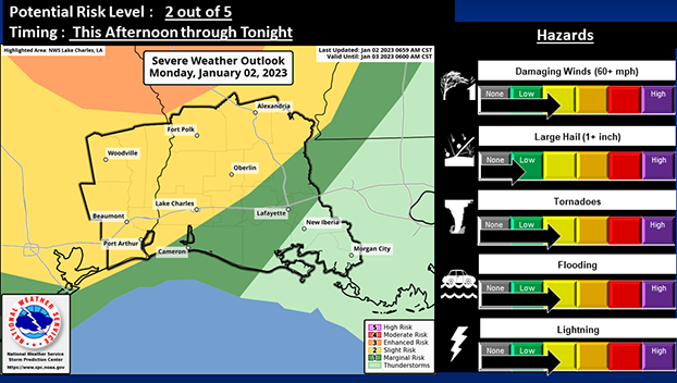
For today, there is a Slight Risk for severe weather (2 out of 5) across all of Southeast Texas, central Louisiana and southwest Louisiana.
There is also a Slight Risk for excessive rainfall (2 out of 4) for interior Southeast Texas and part of the west Louisiana parishes.
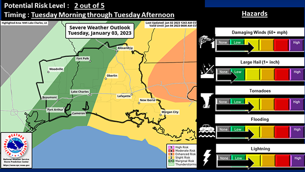
For Tuesday, there is a Slight Risk for severe weather (2 out of 5) for the I-49 corridor and Acadiana in Louisiana.
There is also a Marginal Risk for excessive rain (1 out of 4) for part of Southeast Texas and nearly all Louisiana parishes.
Isolated to scattered showers and storms will begin across parts of Southeast Texas early this afternoon and across parts Louisiana by late afternoon/evening.
Showers and storms will remain fairly scattered overnight; however, the severe storm and heavy rain potential will continue.
Tuesday, storms will start to become more organized and widespread by the early morning, with a squall line features expected to develop along an approaching cold front.
Showers and storms will continue through much, if not all, of Tuesday morning before gradually coming to an end west to east Tuesday afternoon/evening.


