MONDAY MORNING UPDATE: Damaging wind gusts, isolated hail and tornadoes could impact SETX
Published 7:41 am Monday, October 24, 2022

|
Getting your Trinity Audio player ready...
|
The National Weather Service stressed Monday morning there is a slight risk of severe weather expected Monday evening into Tuesday morning due to a cold frontal passage.
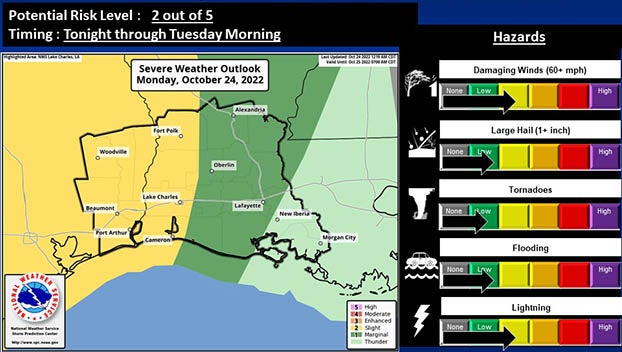
(Courtesy of the National Weather Service)
The main concern is damaging wind gusts; however, there is an isolated risk of hail and tornadoes.
Heavy rain is expected, and flooding of low lying areas is possible.
The impacted areas of all Southeast Texas counties, as well as the western most Louisiana parishes, reside in the Slight Risk (2 out of 5) category, which is where the greatest threat will likely set up.
A Marginal Risk (1 out of 5) covers the remainder of the Louisiana parishes.
Showers will begin overnight at approximately 12 a.m. Tuesday, increasing in coverage and intensity thereafter.
A squall line is expected to move through from west to east along the front, which is where the greatest severe threat is expected.
This line should arrive in Southeast Texas at roughly 3 a.m. Tuesday and exit Acadiana in Louisiana by 10 a.m. Tuesday.
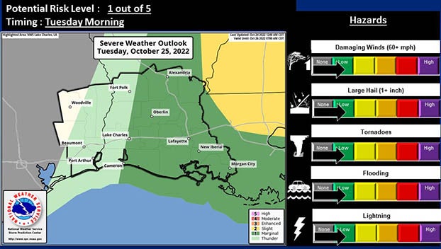
(Courtesy of the National Weather Service)