Weather Service shares tropical depression concern for Gulf of Mexico disturbance
Published 9:07 am Wednesday, June 29, 2022

|
Getting your Trinity Audio player ready...
|
As of 8:45 a.m. Wednesday, the National Weather Service said there remains an area of low pressure over the northwest Gulf of Mexico with disorganized showers and thunderstorms.
The surface low has not become better organized, but there is a 40-percent chance of tropical development as it moves west-southwest toward the middle to lower Texas coast.
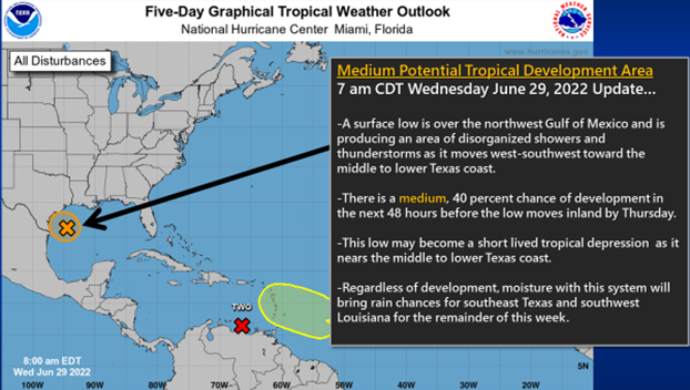
(Courtesy of The National Weather Service)
The storms are expected to move inland Thursday and could become a short-lived tropical depression.
Extra moisture with this system should bring a chance for showers and thunderstorms this week across Southeast Texas, as well as southwest, south central and central Louisiana.
Otherwise, no significant impacts are expected for this area, according to the Weather Service.
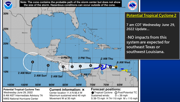
(Courtesy of The National Weather Service)
Potential Tropical Cyclone 2 is likely to become Tropical Storm Bonnie on Wednesday as it moves west near the northern coast of Venezuela.
No Impacts from this system are expected for Southeast Texas, as well as southwest, south central and central Louisiana.
Finally, there is a tropical wave over the central Atlantic some several hundred miles east of the Windward Islands.
There is a 10-percent chance of development in the next 48 hours, and a 30-percent chance for tropical development over the next five days.
The storm is moving west-northwest into the Caribbean Sea.
This system is several days away and it is too early to say if it will survive the trip across the Caribbean Sea and reach the Gulf of Mexico or if it will have any impacts for Southeast Texas.
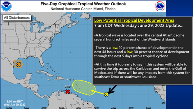
(Courtesy of The National Weather Service)