Weather Service: Southeast Texas residents need to prepare for potential hurricane
Published 12:02 am Saturday, September 11, 2021
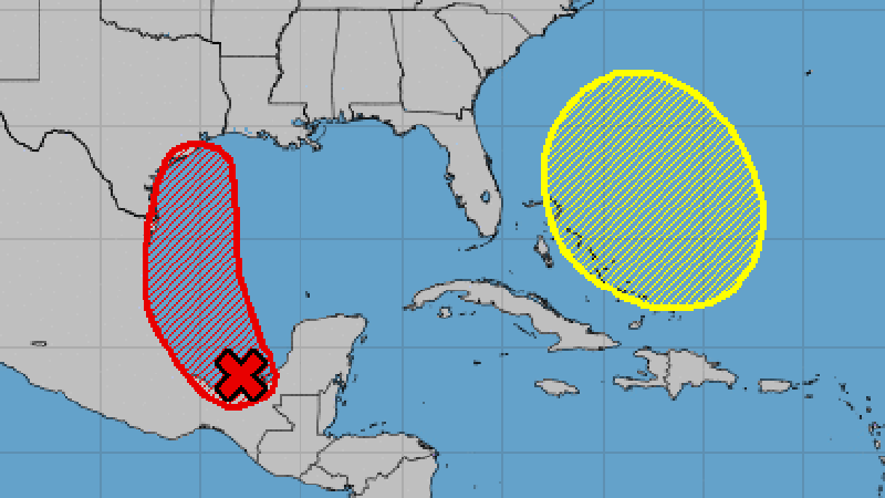
- The National Weather Service released this storm track Saturday afternoon.
|
Getting your Trinity Audio player ready...
|
The National Hurricane Center indicated Saturday afternoon there is a 90 percent chance for tropical development for the system in the Bay of Campeche.
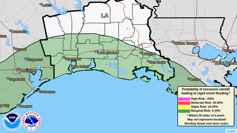
Excessive rain chart warning for Sunday from the National Weather Service.
A tropical depression or tropical storm is expected to form Sunday or Monday, and track north along the Mexico and Texas coast.
READ HERE: National Weather Service releases 7 a.m. Sunday storm update.
According to the National Weather Service, if the stays over the water beyond Monday, it has the potential to be a category one hurricane before it reaches Southeast Texas or southwest Louisiana.
“Regardless of if it becomes a tropical storm or hurricane, we are forecasting a significant amount of rain for Southeast Texas and southwest Louisiana,” Warning Coordination Meteorologist Roger Erickson said.
“Five to ten inches of rain is expected, with locally higher amounts of 15 to 20 inches possible. Expect to see street flooding during periods of heavy rain Monday and Tuesday, and potentially water entering homes and businesses.”
With tides expected to be one to two feet above normal Monday and Tuesday, water will have a more difficult time to drain as well.
Minor coastal flooding can be expected during high tides Monday and Tuesday.
Finally, winds will be gusty Monday and Tuesday in Southeast Texas and southwest Louisiana.
Gusts of 25 to 35 mph could blow down some tree branches and cause a few power outages.
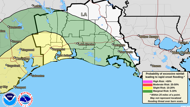
Excessive rain chart projection for Monday.