Ida continuing to strengthen to category 3 or category 4 hurricane
Published 12:02 am Saturday, August 28, 2021
|
Getting your Trinity Audio player ready...
|
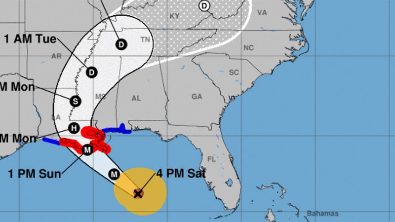
Ida is continuing to strengthen this afternoon, and could become a category 3 or even a category 4 hurricane later this afternoon or tonight.
Landfall projections have shifted a little more to the east, just west of Port Fourchon, Sunday afternoon or evening.
What that means for our region, the tropical storm warning is dropped for Vernon, Beauregard, and Calcasieu Parishes, and the hurricane warning is replaced by a tropical storm warning for Avoyelles, Evangeline and Acadia Parishes.
Hurricane warnings will continue for Vermilion, Iberia, St. Mary, St. Martin, Lafayette and St. Landry Parishes.
For Southeast Texas, we are expecting wind gusts of 20-40 mph and less than an inch of rain Sunday and Monday.
For southwest Louisiana, we are expecting wind gusts of 20-40 mph, and less than two inches of rain Sunday and Monday.
For central Louisiana, we are expecting wind gusts of 20-50 mph, and 1-4 inches of rain.
For south central Louisiana, we are expecting wind gusts of 30-90 mph, with the highest gusts south and east of New Iberia, and 4-10 inches of rain.
Tides will run one to three feet above normal, locally up to seven feet in places.