4 pm storm track moves Tropical Storm Ida away from Southeast Texas
Published 4:23 pm Thursday, August 26, 2021
|
Getting your Trinity Audio player ready...
|
Tropical Storm Ida has formed.
It will come into the Gulf of Mexico by Friday night, according to the National Weather Service, and head north to northwest.
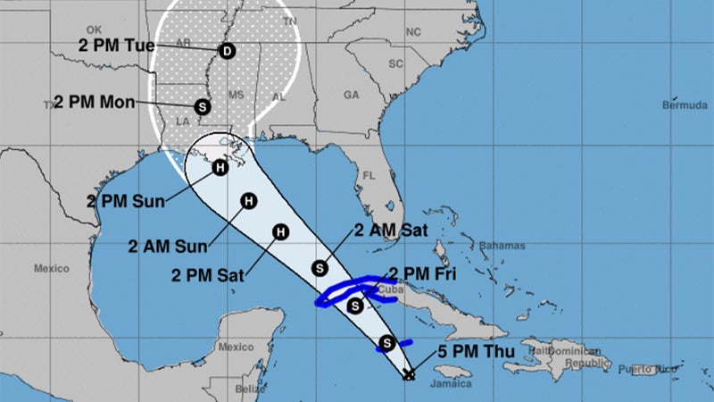
The National Weather Service released this tract Thursday afternoon.
“It is expected to strengthen to a major hurricane (category 3 or stronger) before it makes landfall in Louisiana late Sunday or early Monday,” Warning Coordination Meteorologist Roger Erickson said.
READ HERE: FRI 4 am STORM WATCH: Tropical Storm Ida grows stronger overnight.
While southeast Louisiana has the highest risk, southwest Louisiana and south central Louisiana are still in the error cone and need to monitor this forecast closely through the weekend.
Southeast Texas is outside the error cone, but should monitor the forecasts as well to see if any shift to the west occurs before landfall.
Life threatening storm surge, damaging hurricane force winds, heavy rains and tornadoes are all risks with this system.
Typically the worst parts of the hurricane are along and to the east of where it makes landfall.