Weather Service shares weekend projections for rain, flooding & high tides
Published 2:59 pm Wednesday, June 16, 2021
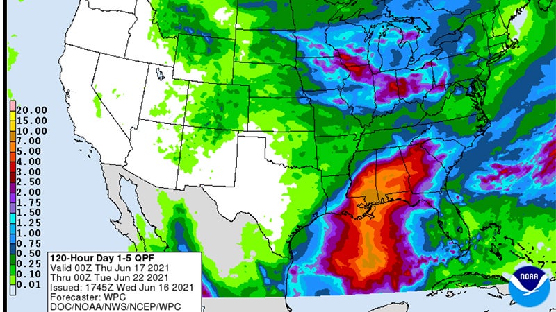
- Rain totals and excessive rain outlook for June 16-22.
|
Getting your Trinity Audio player ready...
|
As of 2 p.m., satellite imagery shows no development Wednesday in the broad circulation in the Bay of Campeche.
Some of the enhanced thunderstorms developing in the Gulf near the Yucatan may serve as a starting point for the potential tropical system, which could happen anytime between late Thursday or into the weekend.
The National Hurricane Center will release a potential storm tract or wind arrival impacts until the storm becomes a Tropical Depression.
There is a 90 percent chance for tropical development in the western Gulf late Thursday through Saturday.
The National Weather Service expects tides to run 1-2 feet above normal. A coastal flood advisory or warning will likely be needed Friday through Sunday.
Rain totals will be 1-5 inches and locally higher if a rain band develops over a certain region.
Expect street flooding in heavier rain bands, Warning Coordination Meteorologist Roger Erickson said.
Isolated tornado threats are possible.
Winds will gust in the 25-30 mph range Saturday and Sunday.