Weather officials share details of today’s risk of 60 mph gusts, hail & tornadoes
Published 9:31 am Wednesday, March 17, 2021
|
Getting your Trinity Audio player ready...
|
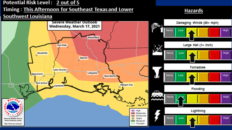
Southeast Texas could be threatened today with thunderstorm wind gusts of more than 60 mph, large hail greater than an 1 inch in diameter and the possibilities of tornadoes.
According to the National Weather Service, the worst weather is expected to hit East Central Louisiana with strong tornadoes, thunderstorm wind gusts over 75 mph and large hail greater than 2 inches in diameter.
Where
Moderate Risk (Level 4 out of 5 ) — East Central Louisiana.
Enhanced Risk (Level 3 out of 5) — West Central Louisiana, South Central Louisiana, and portions of Southwest Louisiana.
Slight Risk (Level 2 out of 5) — Southeast Texas, Lower Southwest Louisiana and coastal Acadiana.
WHEN:
Southeast Texas — between 10 a.m. and 3 p.m.
Southwest Louisiana and West Central Louisiana — between noon and 5 p.m.
East Central and South Central Louisiana — between 2 and 7 p.m.