TUESDAY 10am UPDATE: Beta weakens to tropical depression; local impact expected
Published 12:02 am Tuesday, September 22, 2020
|
Getting your Trinity Audio player ready...
|
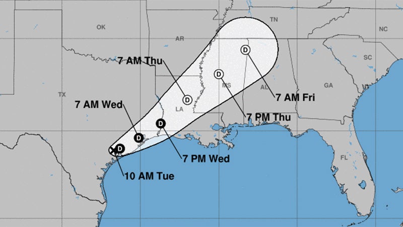
Beta has weakened to a tropical depression near Victoria, according to the National Weather Service.
It will move up the coast towards Southeast Texas Wednesday and Thursday, as a tropical depression or remnant low.
Warning Coordination Meteorologist Roger Erickson said wind gusts of 20 to 40 mph are expected Tuesday, with the highest winds along and south of I-10 in Southeast Texas and southern Louisiana.
An additional one to five inches is possible through Thursday.
Where the rain bands set up will be the location for possible flooding, Erickson said.
Storm surge of one to three feet above ground level will continue during high tides across the coast of Texas and Louisiana Tuesday night through Friday.
There is a small threat for an isolated tornado in Southeast Texas and southern Louisiana today.
As of 10 a.m. Tuesday, the storm is 180 miles from Port Arthur.
At Sabine Pass, tides will run 2 to 3 feet above normal Tuesday night into Wednesday, and drop a little each day through the remainder of the week.
At Rainbow Bridge near Bridge City, tides will run over 2 feet above normal through Friday.
The excessive rainfall outlook calls for a moderate risk (20%) for Southeast Texas and coastal Louisiana on Tuesday.