4 p.m. Saturday update: Beta is stationary, slow west drift expected
Published 4:24 pm Saturday, September 19, 2020
|
Getting your Trinity Audio player ready...
|
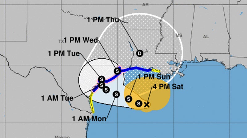
Beta is stationary.
According to the National Weather Service, the storm is expected to resume a slow west drift Saturday night, and be near the middle of the Texas coast on Monday.
A tropical storm warning is in effect for Jefferson County and Cameron, and Vermilion Parishes.
Occasional wind gusts of 30 to 40 mph are expected Sunday, especially near the coast.
Warning Coordination Meteorologist Roger Erickson flooding from heavy rain is likely across most of the region.
Five to 15 inches of rain with locally higher amounts is expected.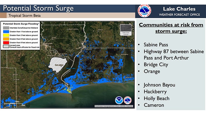
The timing of the heaviest rain is Sunday through Wednesday.
Storm surge of one to four feet above ground level is expected during high tides across the coast of Texas and Louisiana through the middle of next week.
As of 4 p.m. Saturday, the storm is 250 miles from Port Arthur.
Tropical storm force wind probabilities for Southeast Texas are between 30 and 60 percent.
Tropical Storm force wind gusts are possible near the coast, and continue through Wednesday or Thursday.
By Monday, Southeast Texas and southwest and south central Louisiana have a slight (10-20%) risk for flash flooding, with a marginal (5-10%) risk in central Louisiana.