TUESDAY 10 am UPDATE: Laura expected to make landfall as Category 3 hurricane
Published 10:26 am Tuesday, August 25, 2020
|
Getting your Trinity Audio player ready...
|
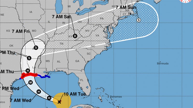
Laura is now a hurricane and still strengthening, according to the National Weather Service.
The landfall projection shows southeast Texas and southwest Louisiana late Wednesday night/early Thursday morning as a Category 3 hurricane.
The storm surge forecast has increased to 9 to 13 feet above ground level for coastal areas. A storm surge warning is now in effect.
Catastrophic and life threatening flooding is expected in the worst hit areas. Hurricane warnings are in effect for all of Southeast Texas and most of southwest Louisiana.
Expect widespread power outages, trees downed, homes and businesses damaged. Rainfall of 5 to 10 inches with locally 15 inches will cause flooded roads. Water rescues will likely be required if people are on the road and stay in the area, according to Warning Coordination Meteorologist Roger Erickson.
Mid-County & Port Arthur
Mid-County and Port Arthur can expect potential for winds of 80 to 115 mph and gusts of 130 mph.
The storm surge could be nine to 13 feet and may overtop the Port Arthur levee system.
Rainfall totals of 4 to 8 inches of rain.