Tracks for Marco, Laura continue to change
Published 12:02 am Sunday, August 23, 2020
|
Getting your Trinity Audio player ready...
|
The tracks for Marco and Laura continue to change.
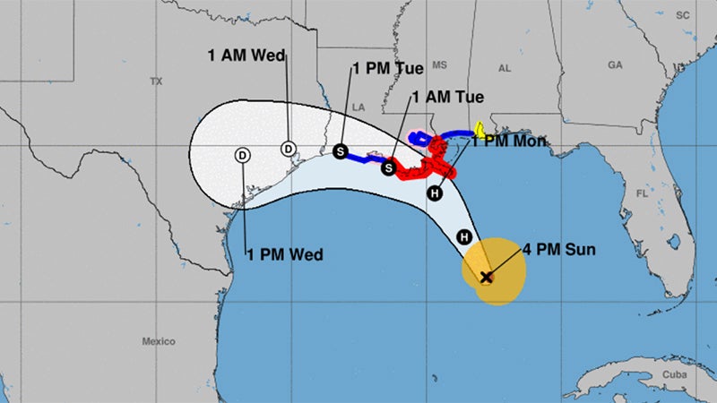
According to a 4:30 National Weather Service update, Marco is now a category one hurricane.
Marco may not make landfall in southeast Louisiana on Monday – it may move west across southern Louisiana or the adjacent coastal waters, weakening as a tropical storm.
Because of this forecast change, a tropical storm warning is now in place as far west as Cameron, Louisiana.
Laura has a large spread for landfall forecasts – anywhere from Southeast Texas (Thursday) to Southeast Louisiana (Wednesday), potentially as a major hurricane.
Here are the forecast impacts from Marco:
Winds: Tropical Storm force winds could occur from Cameron, Louisiana, eastward along the coast, possibly extending inland to the I-10 corridor.
The timing would be in the late Monday-early Tuesday time frame for south central Louisiana and during the day Tuesday for southwest Louisiana.
Storm Surge: Water 1 to 3 ft above ground level is possible for the southwest and south central Louisiana coast, in the late Monday-Tuesday time frame.
Rainfall: Depending on where the rain bands form, local amounts of 2 to 4 inches are possible Tuesday.
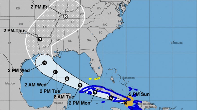
Here are the forecast impacts from Laura:
Winds: Hurricane force winds will be possible across the region starting late Wednesday and continuing Thursday.
Storm Surge: At the coast, water could be over 10 feet above ground level. Depending on where Laura makes landfall, storm surge can back up rivers and bayous and flood over 30 miles inland.
Rainfall: Depending on where the rain bands form, 5 to 10 inches with locally 15 inches will be possible starting Wednesday into Thursday.